Historical Conference
Welcome to the website of the historical conference of GHD Ubbo Emmius!
On the 14th of June 2024, the Conference Committee of GHD Ubbo Emmius will be hosting a conference titled "Threads of Identity: Exploring the Intimate Bond between Clothing and Counterculture."
This year, the conference will be dedicated to the connection between clothing and counterculture. It will explore both the evolution of the discipline as well as its social, cultural and political implications. Clothing and counterculture have played a key role in shaping perceptions and understandings of the world throughout history, both within and between cultures.
Clothing is an important part of our identity, after all. Throughout history, clothing has been used as a way to protest against the norm and as a way to form an identity. From flappers in the 1920s to hippies in the 1960s... During this conference, these expressions of identity throughout history will be explored and celebrated.
About the Conference
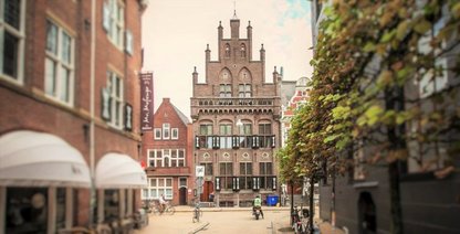
The historical conference will take place on Friday 14th of June in the Van Swinderen Huys in Groningen. Walk-in with coffee/tea will be between 09:00-9:30 AM, the program will start at 9:30 AM until 17:00 PM.
The day-program is filled with three plenary lectures (60 min. each), with room for questions after each lecture. There will also be possibility for further questions at the end of the day. Furthermore, there will be two workshop rounds (45 min. each) where you can choose from three workshop options.
In-between lectures and workshops will be coffee/tea breaks, and a delicious lunch, provided by Van Swinderen Huys, is also included. We would also like to invite everyone to a drink and further discussion afterwards!
Tickets cost €12,50 for Ubbo members and €15,40- for non-Ubbo members, this is including lunch. You can order your ticket via www.ubbo-emmius.com or use the link above
Visit our social media pages for the most recent updates about the conference.
Tickets
Ticket prices are €12,50 for Ubbo members and €15,40- for non-Ubbo members.
Day Program
09:00: Walk-in
09:30: Word of welcome
09:45-10:45: Lecture 1, by Prof. Smelik
10:45-11:00: Drink/Coffee Moment
11:00-12:00: Lecture 2, by dr.Tynan
12:00-13:30: Lunch
13:30-14:15: Workshop Round 1
14:30-15:15: Workshop Round 2
15:30-16:30: Lecture 3, by dr.Roberts
16:30-17:00: Questions and Closing Word
17:00-18:00: Drinks
Speakers
Benjamin B. Roberts
Counterculture in Rembrandt’s Youth
With his bushy, long hair and gold earring, Rembrandt was no stranger to pushing gender boundaries. Today, if someone would look at the
self-portrait of the 22-year-old painter, they might even identify him as ‘queer’.
Rembrandt’s generation of young men came of age in the 1620s
and 1630s and rebelled against the older generation. One of the
principle means of defying themselves from the previous generations was through rebellious acts of sporting different clothing, daunting another hairstyle style, and facial hair. Often, their new choice in clothing challenged existing notions of masculinity and blurred conventional gender boundaries, which older men condemned as effeminate.
This lecture will address the new fashion of young people in the early seventeenth
century and examine how it unleashed a counterculture that changed men’s
fashion and behavior.
Benjamin B. Roberts is a freelance journalist and historian specialized
in early modern Dutch education, youth culture, and life stages. He received a master’s in early modern history at the Vrije Universiteit of Amsterdam, and a Ph.D. in the history of education at the
Rijksuniversiteit Groningen. Currently he teaches Media, Journalism, and
Society at the University of Amsterdam in the summer. His forthcoming new edition Sex, Drugs, and Rock ‘n’ Roll in Rembrandt’s Time (June
2024) reevaluates sexuality and LGBT+ culture in the early seventeenth
century, together with blurring gender boundaries.
Jane Tynan
Subversive fashion practices and speaking truth to power
In highlighting the connection between truth and power this talk considers alternative modes of body fashioning and the challenge they represent to the political establishment.
I use post- structural theories of philosopher/historian Michel Foucault to demonstrate that fashion both produces and critiques discourses of power. Here, the subject of power is defined not by ideology, but action. Various subversive fashion practices have characterized recent instances of civil disobedience and a new generation of activists are contesting the powers-that-be with counter-discourses in the form of hoodies, masking, theatrical costume, and uniforms.
I explore the significance of subversive fashion practices from a Foucauldian perspective to argue that the body is a battleground in our society, a problem intensified by the prevalence of surveillance systems. Personal appearance has taken on a new significance in the light of 'culture wars,’ which has prompted reactionary forces to search for deviance on the streets, online and in the workplace. We have seen moral panics pivot on the styling of the body in various settings, from anti-war demonstrations to disputes on gender. Foucault offers insights into these dynamics, revealing dressing as a political act and the body as key site of resistance
in everyday struggles for power.
Jane Tynan is Assistant Professor Design History and Theory in the Faculty of Humanities, Vrije Universiteit Amsterdam, where she is program lead for MA Design Cultures. Her research primarily concerns histories of fashion, clothing and the body with a focus on questions of citizenship, power, governance and public trust. Other research interests include socio-technical imaginaries, the militarization of popular culture, material histories and artdesign collaborations. Recent books include Uniform: Clothing and Discipline in the Modern World (2019) and Trench Coat (2022). She is editor of the book series Palgrave Studies in Fashion and the Body.
Anneke Smelik
Hippie influences in Dutch fashion
Dutch fashion has it all: vibrant colours, sculptural forms, flowing fabrics or naughty prints and designer blue jeans. Think of G-star or baroque designs by fashion artists Viktor&Rolf, hippie designers The People of the Labyrinths, punk designer Bas Kosters, or Moroccan-Dutch designer Mohamed Benchellal.
In this lecture, fashion scholar Anneke Smelik explores
how Dutch designers take their inspiration all the way back to the youth cultures of the 1960s. Fashion styles moved from top-down haute couture to bottom-up street culture. The lecture will discuss why this form of democratization was particularly strong in the Netherlands. And how individualism has countered conformism, from fashion queen of the 1970s, Mathilde Willink, to fashion performer Aynouk Tan today.
Anneke Smelik is Emerita Professor of Visual Culture at Radboud University Nijmegen. She has published widely in the field of fashion, cinema, popular culture and cultural memory.
Among her books are Delft Blue to Denim Blue. Contemporary Dutch Fashion and Thinking Through Fashion. A Guide to Key Theorists. She is co-editor of the journal Critical Studies in
Fashion&Beauty. For more information: www.annekesmelik.nl
Workshops
Redesign your own clothing
Turn your clothing into a protest sign! The way we dress has always been a way to express ourselves. Whether it concerns how you dress in everyday life or if you are part of a certain movement within society. It affects the way you feel and the way you are perceived.
During Blousem's workshop you'll transform your clothing into a protest sign to express, in quite a literal way, what you stand for or where you want to see change. You'll be using different upcycle techniques like patchwork and embroidery to do so. Make sure to sign up for one of the two workshop rounds and let your voice be heard via your clothes!
Important: bring your own piece of clothing you'd like to use for the workshop. Make sure it is made of sturdy fabric like jeans or (non stretchy) cotton. If you prefer you could also use a canvas bag.
Make sure to follow Blousem on Instagram @blousem_nl or visit their website!
Knitting patterns in the 16th century
Syberich Willems & Aylcke Huninga:
A story about the 16th-century daily life of knitters in Groningen. Based on true, historical facts and events, Syberich Willems and Dyveke truly experienced their dramatic lives, and the Huninga family is one of the oldest families that has been mentioned in the history of Groningen and surrounding areas since 1440.
In this book, you will also find my knitting pattern for the sock, which we will discuss in the workshop, as well as the daily life of knitters and people in the 16th century at the Alpha Canal in Groningen, where they lived and worked, allowing both knitters and non-knitters to identify with them.
Counterculture and squatting
Kraaiennest is a community centre that has completely immersed itself in counterculture. In this workshop they will teach you all there is to know about fashion in the present counterculture and how it connects to squatting!
Chair of the Day
Details will be revealed later on.
Location
The conference will take place at the Van Swinderen Huys, Groningen
Tickets
Ticket prices are €12,50 for Ubbo members and €15,40- for non-Ubbo members.
Past Conferences
June 14th, 2024: Threads of Identity: The Close Relationship between Clothes and Counterculture
June 16th, 2023: Terra (In)Cognita: Mapping the Past, Present and Future
June 10th, 2022: A Culinary Exchange: Food History through Time and Space
October 8th, 2021: The Long Century of Transformation: From Nation-State to a Federative Europe? (1848-Present)
June 19th, 2020: The Arab Spring: A Narrative of Fighting and Framing (cancelled due to Covid-19)
2019: Continuity and Discontinuity in Chinese History
2018: Capturing Calvinism: Calvin’s Conquest of the Dutch Community
Copyright © Alle rechten voorbehouden


